
Over the Top of Oz: August 6 2008
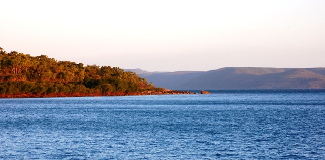
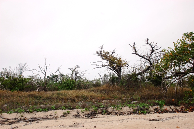
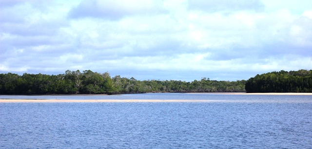
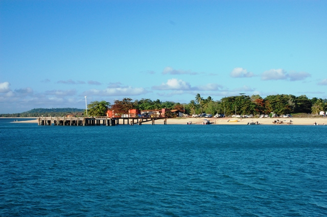
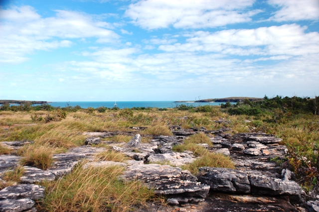
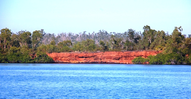
July 19 we pulled up the anchor at 4:30am from Watson's Bay of Lizard Island. The bright moon helped the night seem less forbidding and the glow was strong enough to illuminate stray bomies in the anchorage. We left soooo early in order to arrive at the Flinders Island Group in daylight...82 miles away. The trade winds filled in and we made great progress solely under sail...almost too good of progress as we rounded Cape Melville doing 11 and 12 knots boat speed with just a scrap of a head sail...yikes. Needless to say we made it to our anchorage well before sunset. And what a lovely spot it is. We were the sole boat anchored in Owen Channel...smooth seas below us and sandy beach to look at ashore. Additionally, Castle Peaks can be seen in the distance...looking like a castle on a hill...as its name suggests...but really only natural occurring rocks. This is a place we could have stayed longer but we need to hit the tide correctly as we go over the top of Cape York which means we need to keep moving.
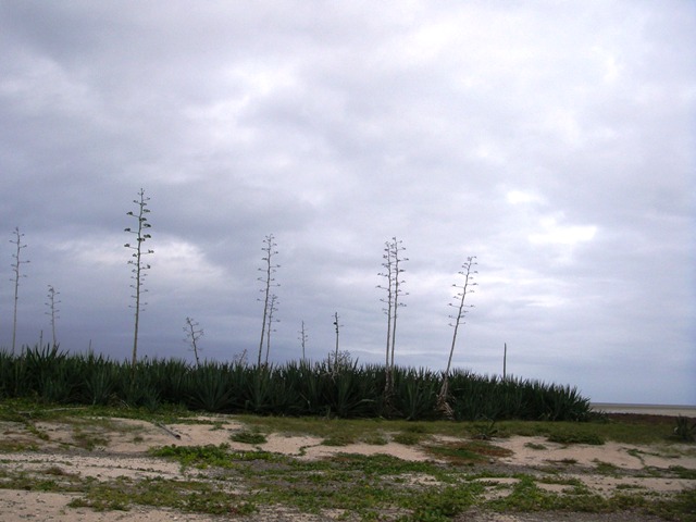
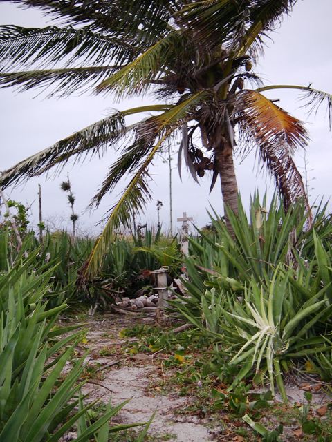
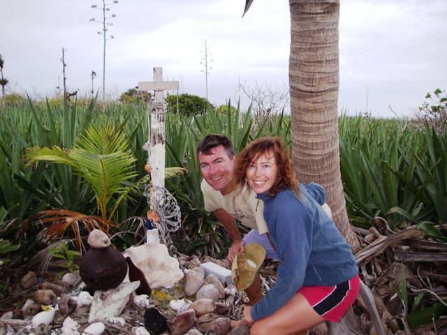
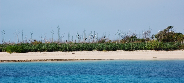
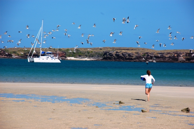
July 20 and out we went through Rattlesnake Channel for a 60 mile run to Morris Island. This stretch of the Australian coast is protected from ocean swell by the Great Barrier Reef which results in marvelously smooth seas. We enjoyed the lack of drama and spent most of our time reading books...and trolling a fishing line. Drat...lost a lure and had an investigatory bump but no bite. Morris Island is a coral cay with sand anchorage and excellent holding. The island is small so we hopped into the dinghy and went ashore...picking up a neighbor boat on the way. Together we walked the perimeter of the island (in about 15 minutes), observed loads of nesting birds and spied the grave of a shell diver. The diver's grave is from the not-so-distant past when pearling and trochus shell luggers ranged far and wide from their home port of Thursday Island. Away for months at a time, deaths in the crew were dealt with on the spot...graves being dug wherever necessary. Another historical note observed on Morris Island was the policy of the last century by the British Admiralty to provide many of the Great Barrier Reef Islands with a means of support for shipwrecked crews. Common implementation of this plan was to put goats ashore (long since removed since they completely denuded islands) and to plant coconut palms with sisal trees nearby. The sisal tree was meant to be used as a tool for knocking down coconuts from the palms. The sisal trees have proliferated...while the coconut tree has not....no excuse for not getting that nut.
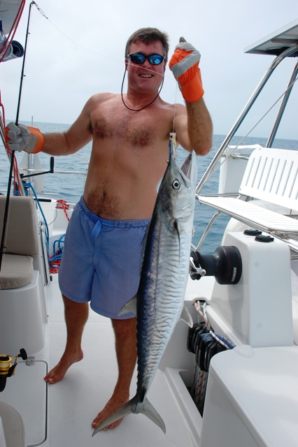
Bill and Carol (m/v XTC) explored the Kimberleys (Western Australia) last year and had tons of information for our trip to Darwin. We went aboard for map review, tide calculations and anchorage ideas...and a glass of home brew beer. Wonderful folks and since we only had a short distance the next day (20 miles)...they joined us for biscuits and coffee before we departed for Night Island (July 21). It was a leisurely day and again out went the fishing rod. Yippee...fish on! This guy was huge and a real runner. Just a few glimpses before he was aboard but he looked like a beauty. Sure enough...after 20 minutes of fight Chris had a gorgeous Wahoo aboard (also called Spanish Mackerel)...good job Barefeet. We guess the Wahoo was 4 feet long and a solid 25 lbs! Seas were smooth so Erin did the filleting immediately. Goodness gracious...it was like carving up a deer...this guy will serve us for several meals...even with Erin's inexact filleting skills (16 portions in all). Oh, but the blood...went everywhere...including all over Erin. It took scrubbing with a brillo pad to get it off her skin after the hour of filleting. Arrival at Night Island and a quick buzz ashore. Maybe it was the grey clouds but this place felt...a bit...haunted. We did not stay long and went back to Barefeet where out came the grill. Oh gosh was that Wahoo delicious...and with just a splash of olive oil and a sprinkling of Santa Maria seasonings...yum.
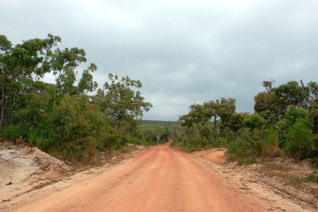
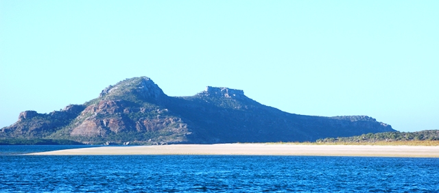
July 22 we were off at 7am for Portland Roads. These daily hops are a bit of a grind but we really need to catch the tide correctly at the tip of Cape York (can be as much as 6 knots of current). Portland Roads is described as "an outpost of civilization." We think that is a bit generous...with only five structures, a lone, part-time cafe and supplies only available via mother ship that services the prawn trawlers...but it is a nice spot. We headed ashore after setting the anchor...winding our way through the shallow coral...and walked along the Iron Range Road. We met a local family getting a home-built catamaran sorted out to start cruising...very nice...but watch out for that home brew rum. It will knock you over! They also own a vacation rental if you are ever in the area...www.portlandroadsbeachshack.com.
Although this is a visually pretty spot Portland Roads is best known because of its military history...the Coral Sea Battle. This decisive battle of WWII stopped Japanese ambitions to occupy Port Moresby (Papua New Guinea) and, eventually, Australia. Fought on 7 and 8 May 1942...this was a sea battle fought solely by aircraft...not a single shot was fired by a ship. Portland Roads was the supply center for Australian and American forces in the area; however, structures and jetties have been dismantled with only ruins remaining.

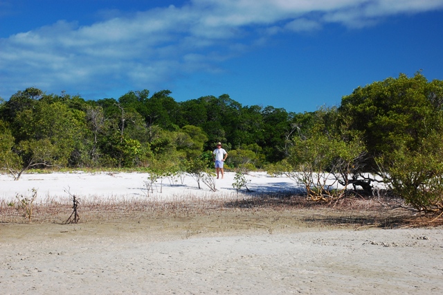

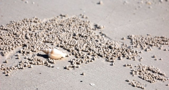
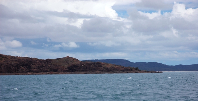
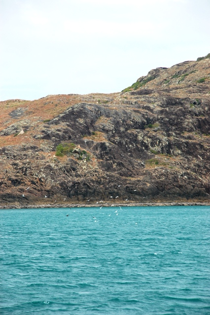
We left Portland Roads and anchored in Margaret Bay off of Cape Grenville (July 23). What a beautiful place...protected bay with sand fringed shores, mangrove forests, palm trees and clear, blue waters. We walked ashore but kept a sharp lookout for crocs...none seen...but we may have spotted a croc print...an s-line in the sand as if drawn by the end of a baseball bat with four "paw" prints ambling along the beach. Erin found a great baler shell! She spotted just the crown sticking out of the wet sand and had to dig it out but it was worth it...whole, intact and bigger than her hand. A quick rinse of sand and it was ready for display. Evidence of soldier crabs was also seen with their tell-tale sand balls outside their sand holes. We had the anchorage to ourselves once the prawn trawler headed out for a night of working. Gosh, these North Queensland anchorages are few and far between but they are spectacular in beauty and serenity.

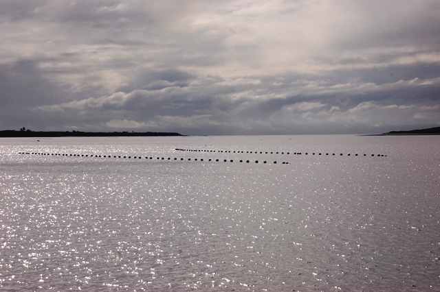
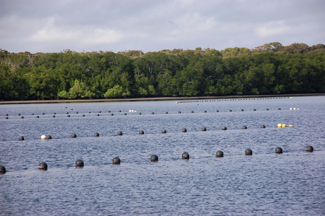
July 24 we left Margaret Bay for a 71 mile day to Escape River. It was another departure before the sun...but under a beautiful star filled sky. Later in the day a dolphin played alongside Barefeet as we calmly made our distance. It was necessary to be anchored in Escape River before sunset due to a pearl farm which has strings of pearls below black floats dotting the river. Additionally, there were a few random rocks that were marked with the smallest of buoys...all was avoided and we were snugly anchored in the mangrove fringed river in time for sundowners on the bow of Barefeet. A synchronized trio of dolphins started the show that morphed into jumping fish (maybe tuna) that splashed back into the water with as much commotion as a cannonball jump from a high dive. Erin took a page out of Paddy's recipe book for dinner by making apricot chicken...quick and delicious. This was a peaceful place with water that was as smooth as glass...heaven for a good night's sleep. Apricot Chicken: sauté two chopped chicken breasts and two chopped onions in butter in a sauce pan; remove from sauce pan and place in baking dish; mix French onion soup mix packet, cracked pepper, 1/2-1 teaspoon fresh ginger and 15 oz apricot nectar together in sauce pan; slowly bring to boil and thicken, stirring constantly; pour liquid over chicken and onions in baking dish; cook uncovered for one hour at 300 degrees F. Serve over rice.

This is it...the day we will round the top of Australia! We have timed the tide and should make good progress to Seisia (July 25). We were both anxious for the milestone and a bit snippy with each other as we completed several sail changes in an attempt to capture the elusive wind. We passed through picturesque Albany Passage and were targeting Cape York. Awesome...at 1:10pm we rounded the northernmost tip of Australia (and a mere 80 miles South of Papua New Guinea). We clicked photos but kept moving to Seisia for the night's anchorage. Seisia is the coastal port for the Aboriginal settlement of Bamaga. It has fuel and a small supermarket just a short walk from the dinghy beach. But first it was time to find cash so we could have burgers and beer tonight at the Fishing Club. We hitchhiked into Bamaga (approx 3 miles away) and found the one ATM...located...inside a supermarket?! With only four minutes to spare we withdrew our money (machine closes at 6pm) and hitched a ride back to the Fishing Club. It was a fun night under a clear sky as we celebrated our milestone...grilled burgers, cold cocktails and live music...wonderful.
We scurried around buying diesel (yikes...$150 for 15 gallons) and provisions making sure we were ready for a good weather window to make the 336 miles across the Gulf of Carpenteria to Marchinbar Island of the Wessel Island Group. We also met a trio of motor vessels...Calypso, Fernanda and Champagne Lady. Wonderful folks headed to Darwin and then onto the Kimberleys next season...and...we did cross paths in Lizard. They were the mob who won the couch raffle at the State of Origin rugby match. Small world.
A good weather window came up fast and off we went July 27 at 7am through the Endeavor Strait. The first two days were slow and steady with light winds. However, the winds cranked up the second night with sail downgrades throughout the night...keeping a good 7 knots boat speed the whole time. That second night also saw Erin's life pass before her eyes. Erin was on watch and settling in...the sun had gone down, the moon had not yet risen and the stars were blocked by clouds...it was as black as a bat's ass (another great Aussie saying). Every 15 minutes I did a scan of the horizon and checked the radar...not a soul to be seen. Then all of a sudden...looking to the right I saw a green and red light on either side of what appeared to be a mast...holy cow...where did they come from?! We are going to be rammed! This is like driving a car and turning your head left only to see headlights 15 yards away. Still nothing on the radar...but they cannot be far away. I quickly called for Chris to come upstairs (not much for him to do but I didn't want to die alone). I switched on the deck lights hoping a last minute swerve was possible...nothing...still that green and red light. All of a sudden you could hear the engine noise - wrrrrrr - then it disappeared and reappeared on the other side of the boat! Good heavens - it was a plane doing a fly-by in the pitch black no more than 15 yards off our stern! Then we heard the Australia Maritime Surveillance on VHF channel 16 (border patrol). They asked for some routine info. I provided the details but asked them to bear with me because my heart had just started beating again after being "startled" by their appearance...they seemed to chuckle through the radio. Chris went back to sleep while I got my heart rate back to normal and stopped shaking. The strong winds and waves (on the beam...very rolly) continued throughout the night and the next day until we were anchored at Marchinbar Island (July 29)...unfortunately, this motion keeps the food going out more than going in...Chris even tossed his cookies minutes before we anchored...aaaggghh.

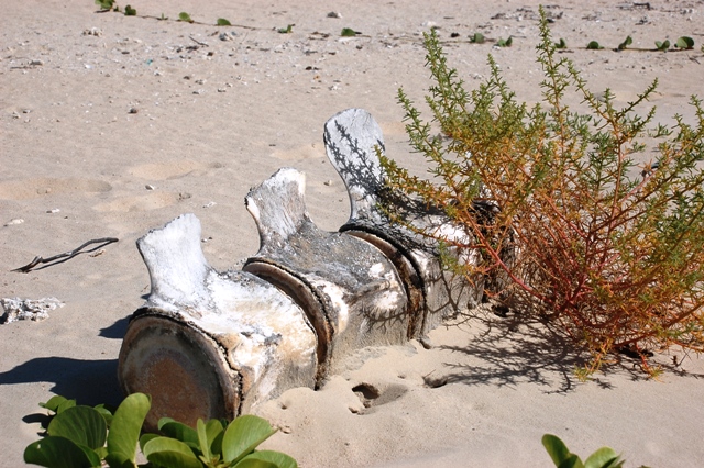
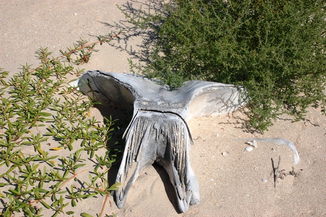
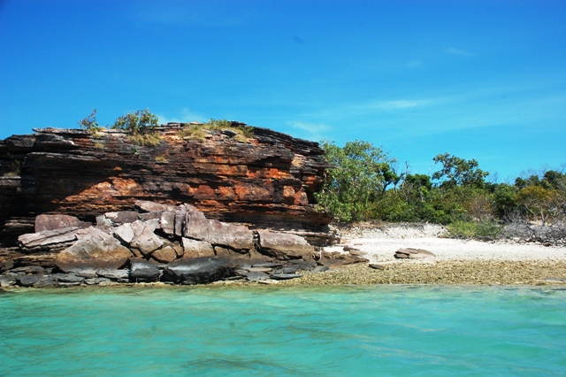
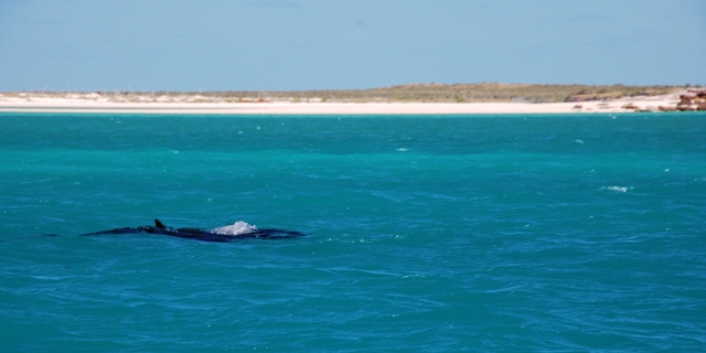
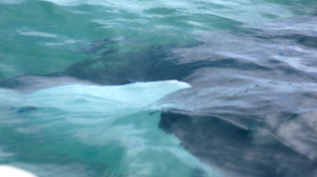
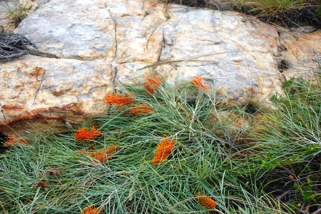
It felt great to be anchored! With empty stomachs we quickly showered and got ready for a steak dinner on the grill. It was fabulous and again we are the only boat in a pristine anchorage. This spot broadly marks a change in Australian geography for us...we have departed the state of Queensland...and entered the state of Northern Territory. Additionally, we have exited the Coral Sea...and entered the Arafura Sea. Specifically, this 500 mile stretch of the "Top End" coast and inland is called Arnhemland (named after a Dutch ship). It is Aboriginal land and home to Northern Australia's most remote and unspoiled wilderness. The landscape has certainly changed from the mangroves and palm trees of the green, tropical regions to rusty, orange sandstone rocks and flat, scrubby plants...but beautiful all the same. July 30 we got up slow...did some laundry and got sorted after the passage. Then it was off to shore. Walking the beach was much more than basic beach combing (although several nice cowries were collected). We saw a whale skeleton washed up along the beach...amazing...vertebrae still in a line, ribs scattered and a skull partially buried in the sand. AND gigantic bird prints... (note comparison to Chris's foot print). Kind of scary to walk a beach not knowing what kind of giant terydactyl kind of thing was stalking around! The return dinghy ride was also memorable as we spotted a huge manta ray. We turned off the engine...and he glided right under the dinghy and out the other side (he was larger than the dinghy).
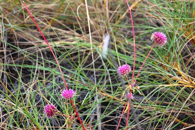
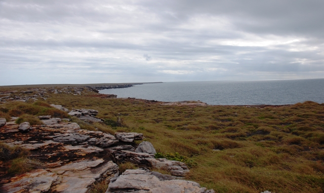
July 31 we suited up in long pants and hiking boots...in case we ran into any snakes or other biting Aussie critter. We headed across the island to see what was beyond the beach...breathtaking...unspoiled landscape and the cliff faced windward side of Marchinbar Island. The infrequent flowers were colorful and the sandstone appeared to have been shaped by the wind. Back on the beach we burned our paper trash below the low tide line...and again met up with the manta ray on the return to Barefeet. Great day...and it was only Noon!
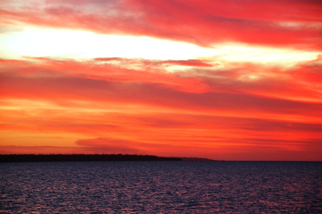


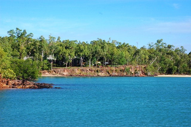
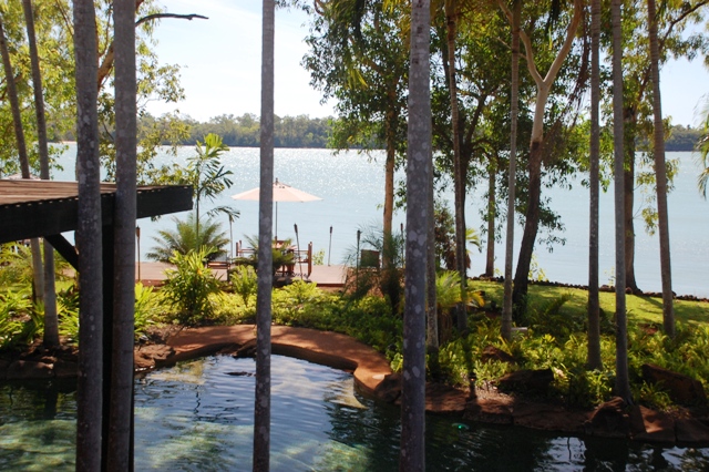
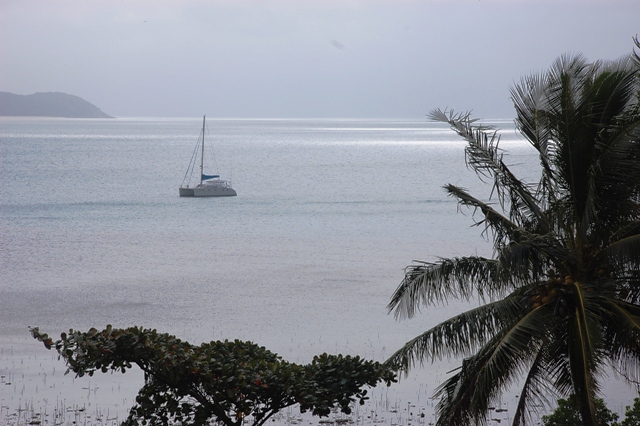
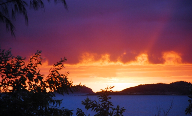
August 1 we left the beautiful Wessel Islands and made a 36 hour spinnaker run to Malay Bay. This was a very civilized passage with wind and waves gently pushing us from behind...Erin even made Mexicali Fish for dinner from scratch and never once popped upstairs for fresh air. The Australian Coast Patrol passed twice per day and asked for boat details...but no more nighttime encounters. Malay Bay was a calm spot and provided an amazingly red sunset...beautiful and a good omen...red skies at night, sailor's delight. Wind and current helped us again August 3 as we made 61 miles to Black Point in Port Essington...part of the Cobourg Peninsula. After initially dropping the anchor on what sounded like a flat table of rock the anchor finally set on the third try...just as the sun was starting to set. August 4 we headed ashore to see the Ranger Station and Cultural Center. Not a soul to be seen so we were unable to pay our "use fee" for visiting these Aboriginal lands...but the Cultural Center was unlocked so we wandered around the museum of exhibits describing the history of the Arnhemland region. We had a nice swamp and beach walk where we saw a kookaburra, a wallaby and many vibrant cowry shells. But we remembered...NO swimming! This is croc country. Then we hopped one hour across Port Essington to Coral Bay. It is a quiet spot with a small wilderness lodge resort...no land access with all guests arriving by plane to this remote and wild destination. It is the Peppers Seven Spirit Bay (www.peppers.com.au) and it is an oasis. We tried to make reservations for dinner but the chef could not accommodate us (supplies only arrive every two weeks via barge)...instead they bought us a drink at the bar in apology...we have yet to meet a grumpy Aussie. At sunset we sat on the bow with olives and a sundowner before making pizza.

August 5 we had pancakes as fuel for our last hop to Darwin...140 miles. Chris has happily adopted Kevin's pancake recipe (no Bisquick out here) and they are delicious. Thanks Kevin! Pancakes: mix in a blender 2 cups buttermilk, 2/3 cup Wesson oil...start blender...2 eggs, 1 teaspoon baking powder, 1 teaspoon baking soda, 1/4 teaspoon salt, 1/3 cup sugar and 1 cup flour. Buttermilk substitute: 1 cup regular milk plus 1 Tablespoon lemon juice (or vinegar). The distance to Darwin is more than we can do in daylight hours but not a 24-hour run which meant we left at 1pm in order to get the tide with us as we passed through the Dundas Strait. It was a roiling sea as we passed Cape Don...loads of whirlpools and 6 knots of current pushing us along at 10 knots boat speed. Winds were light which took most of the drama out of the situation but it was still a bit hairy as we passed through narrow shipping lanes between shoals and islands...in the dark of night. Seeing Darwin was a bit of a shock after so much solitude (Aug 6). This is a big city with skyscrapers, super tankers and war ships. We anchored at 10am in Fannie Bay to await the Australian Fisheries Department visit at 3pm. They SCUBA-ed under Barefeet looking for nasty muscles and "prophylactiquely" fumigated the salt water systems. This "service" is free to us but means we cannot enter the marina for one more day (August 7) because the poison needs to "sit" and kill stuff for 14 hours...plus, no use of salt water systems during that time. Thank heavens our toilets are fresh water toilets. We hope to head into the Darwin Sailing Club for a celebratory dinner but the tide is 17 feet today and that would make for a LONG dinghy drag if the tide is not in our favor. We will see how it goes. Well, it's true what they say...the right tool makes all things possible. The Sailing Club has wheeled dinghy cradles to help with the tide issue...perfect. Dinner was at picnic tables on a giant grass lawn overlooking Fannie Bay (wow - cannot remember the last time we saw grass). Back to Barefeet and we slept like rocks. Now just waiting for high tide in order to pass through the lock into the Cullen Bay Marina. Yes, all marinas in Darwin have locks due to the dramatic tides (up to 24 feet). Then it will be a bit of frenzied energy to get Aussie and Indo paperwork rolling, boat projects underway, specific planning for Indonesia and maybe a couple of days inland...tick tock...Aussie visas expire August 26.